|
Return to
Photo
Index
Return
to Clickable Map
Return to Home Page |
|
|
|
|
Travel Pictures - SOUTH VIETNAM -
September 2001 |
|
| All images © Ron Miller |
|
|
|
|
|
The travel photos begin at Saigon (Ho Chi Minh
City) in South Vietnam and progress
in a northerly direction to
the hill station of Dalat and proceed along the coastline to
Nha Trang, Danang, Hoi An, and
eventually Hanoi in North Vietnam. The photos
conclude with the stunning
scenery of Halong Bay in the northeast corner of Vietnam. |
|
|
|
|
|
|
|
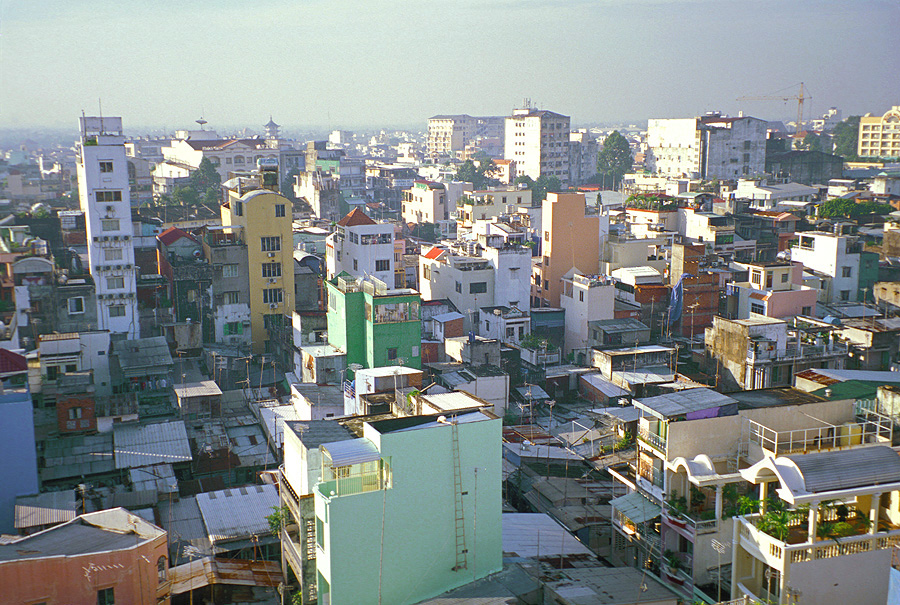
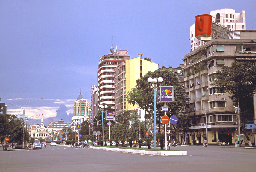
Colorful vista from the rooftop
of our hotel; at the time of the photo (2001), Saigon had a population
of five million -
Ho Chi Minh City (Saigon), South Vietnam |
|
|
|
 |
|
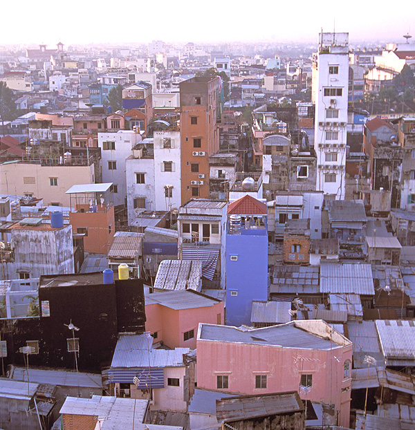
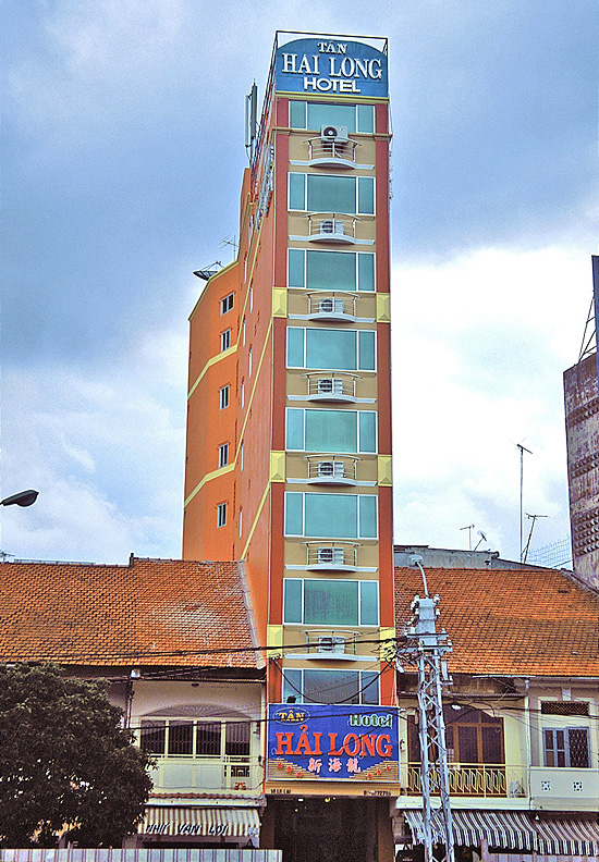
Close-up view of the structures
that give the city's skyline the appearance of upright dominos -
Ho Chi Minh City (Saigon), South Vietnam |
|
|
|
 |
|
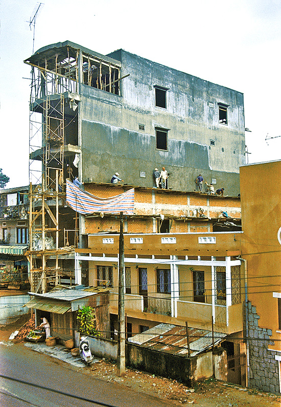
Vietnamese construction
practices (especially for dominoes) probably fall short of OSHA standards
-
Ho Chi Minh City (Saigon), South Vietnam |
|
|
|
 |
|
You must be asking, "Why
construct such a narrow building?" -
Ho Chi Minh City (Saigon), South Vietnam |
|
|
|
 |
|
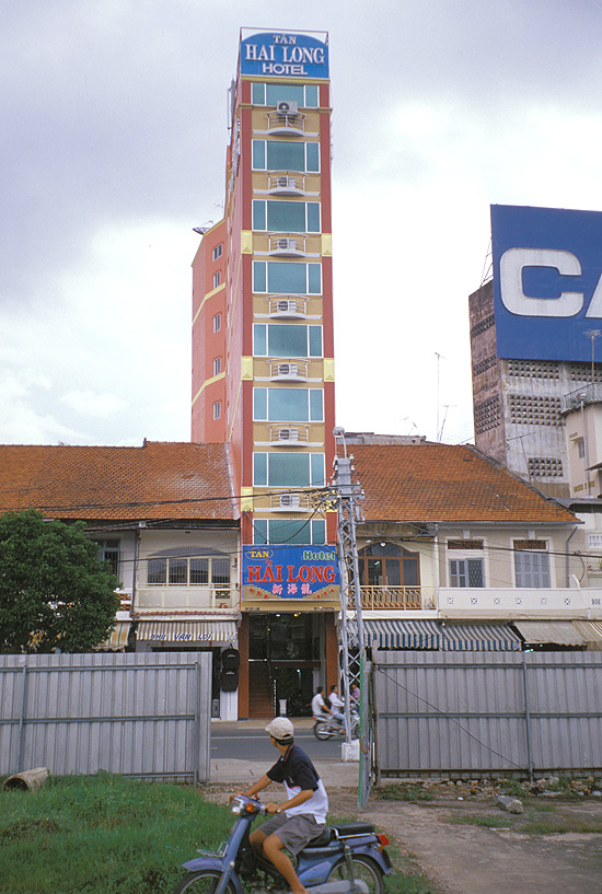
I asked and was told
that taxes in the new Vietnam are levied based on curb length! -
Ho Chi Minh City (Saigon), South Vietnam |
|
|
|
 |
|
In the center of the commercial
district is Nguyen Hue Street with the Hotel Deville seen in the distance
-
Ho Chi Minh City (Saigon), South Vietnam |
|
|
|
 |
|
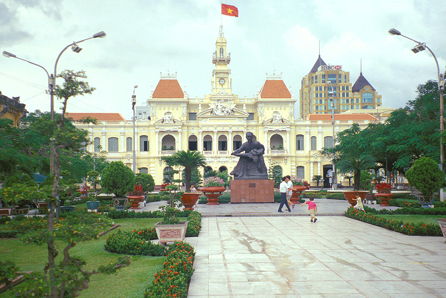
The former Hotel de Ville de
Saigon was constructed in 1908 and recently renamed the "People's Committee
Building" in 1975;
visitors today can only enjoy the facade since "the people"
are prohibited from entering to witness exactly what is being done for
the people -
Ho Chi Minh City (Saigon), South Vietnam |
|
|
|
 |
|
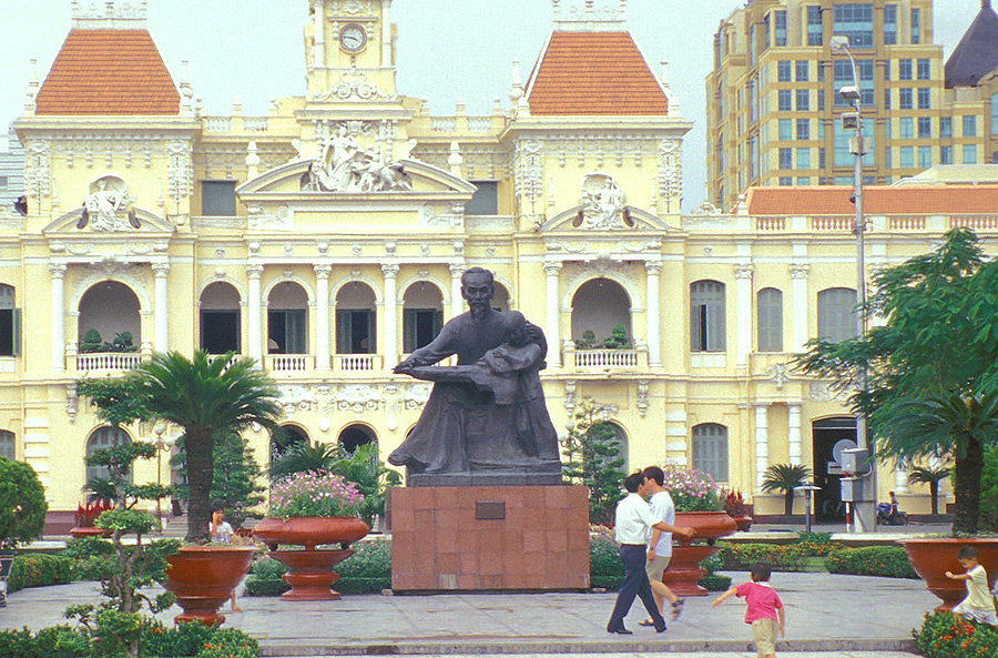
The lovely French Colonial
architecture adds elegance to this "dark" statue of Ho Chi Minh
-
Ho Chi Minh City (Saigon), South Vietnam |
|
|
|
 |
|
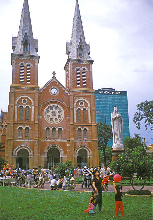
Throngs of curious Vietnamese
congregate outside the Notre Dame Cathedral
whose 190-foot-tall towers were completed in 1880 during French occupation -
Ho Chi Minh City (Saigon), South Vietnam |
|
|
|
 |
|
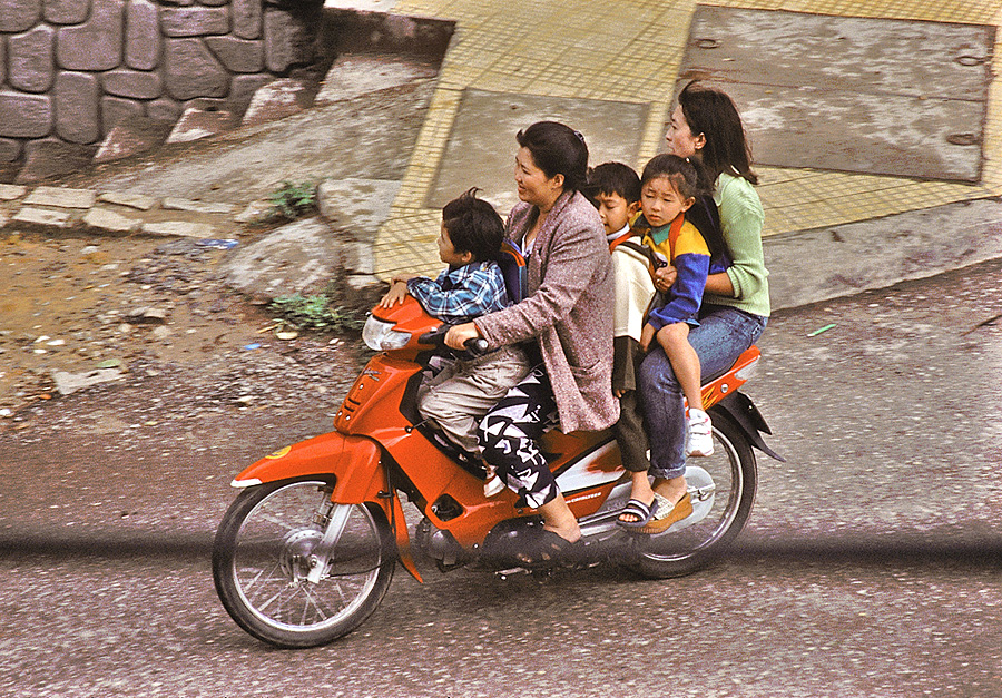
The typical family sedan in
Vietnam has only two wheels with a design that allows passengers to fully
take in the scenery -
Ho Chi Minh City (Saigon), South Vietnam |
|
|
|
 |
|
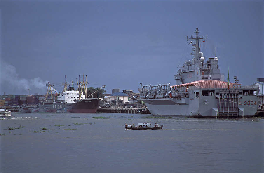
These freight and military ships
are safely
anchored on the banks of the Saigon River (or has the river also been renamed?) -
Ho Chi Minh City (Saigon), South Vietnam |
|
|
|
 |
|
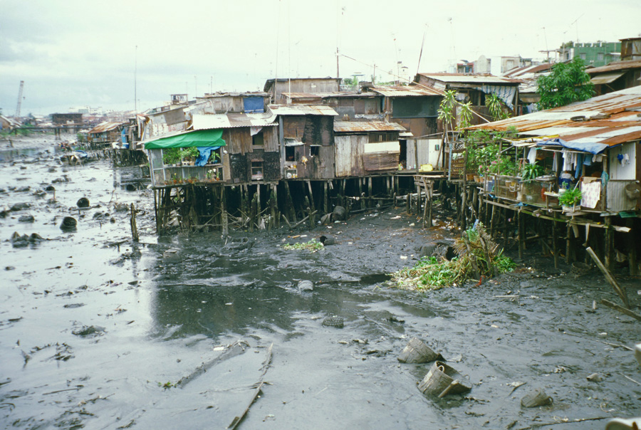
The slum areas can look (and smell)
particularly unpleasant at low tide -
Ho Chi Minh City (Saigon), South Vietnam |
|
|
|
 |
|
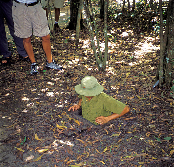
Our Vietnamese guide (a
translator for the Americans during the conflict) demonstrates how to access
one of the Viet Cong's hidden tunnels used during the Vietnam War (or was it the American
War?);
the camouflaged cover can barely be seen on the ground directly in front of the guide; the
openings
were just wide enough for a Viet Cong soldier but too small for the average American
soldier -
Cu Chi Tunnels, South Vietnam |
|
|
|
 |
|
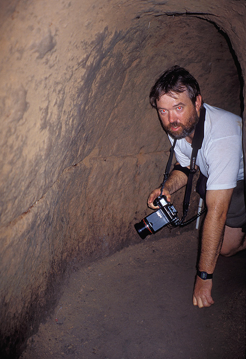
Brian crawling slowly within the
underground labyrinth of passageways; this subterranean
form of warfare was first developed against the French; Viet Cong soldiers
lived completely
hidden underground and came out only at night to terrorize the South
Vietnamese -
Cu Chi Tunnels, South Vietnam |
|
|
|
 |
|
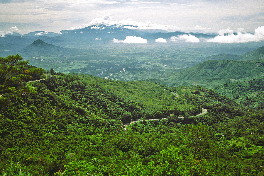
View down to the lowlands from
the twisting road that leads to the old French hill
station of Dalat in the south-central highlands -
near Dalat, South Vietnam |
|
|
|
 |
|
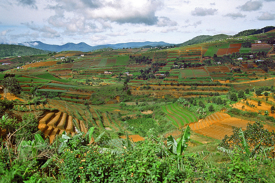
The cultivated highlands produce
a variety of crops -
near Dalat, South Vietnam |
|
|
|
 |
|
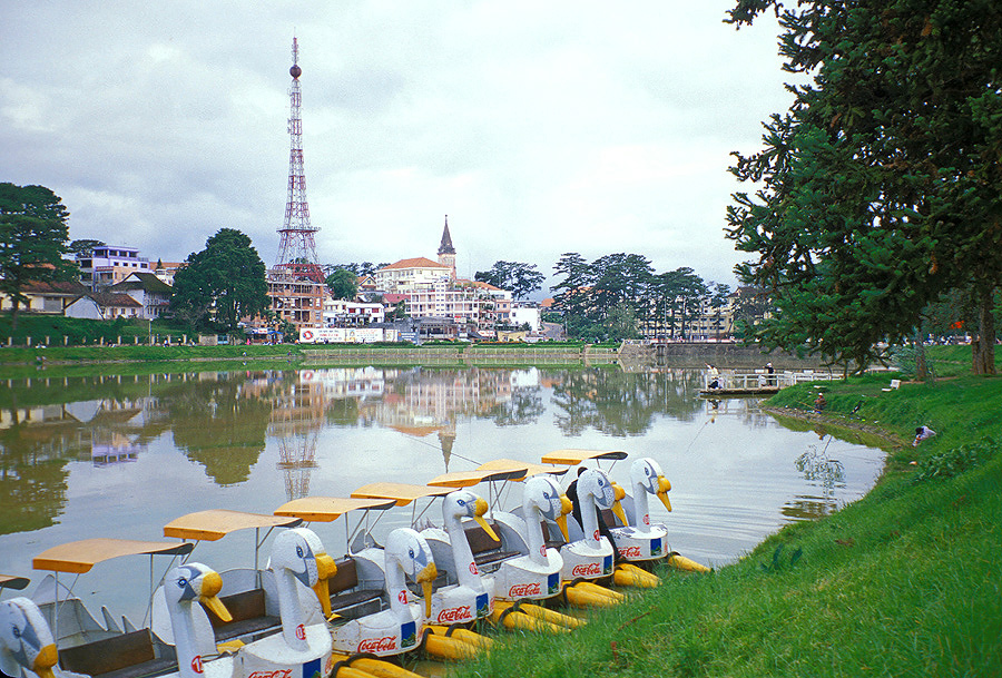
The hill station of Dalat,
with its miniature Eiffel Tower, was once referred to as "Le Petite
Paris"; Dalat is Vietnam's honeymoon capital and,
situated at nearly 5,000 feet, has an average daytime temperatures in the
70's - an especially valuable commodity prior to air conditioning -
Dalat, South Vietnam |
|
|
|
 |
|
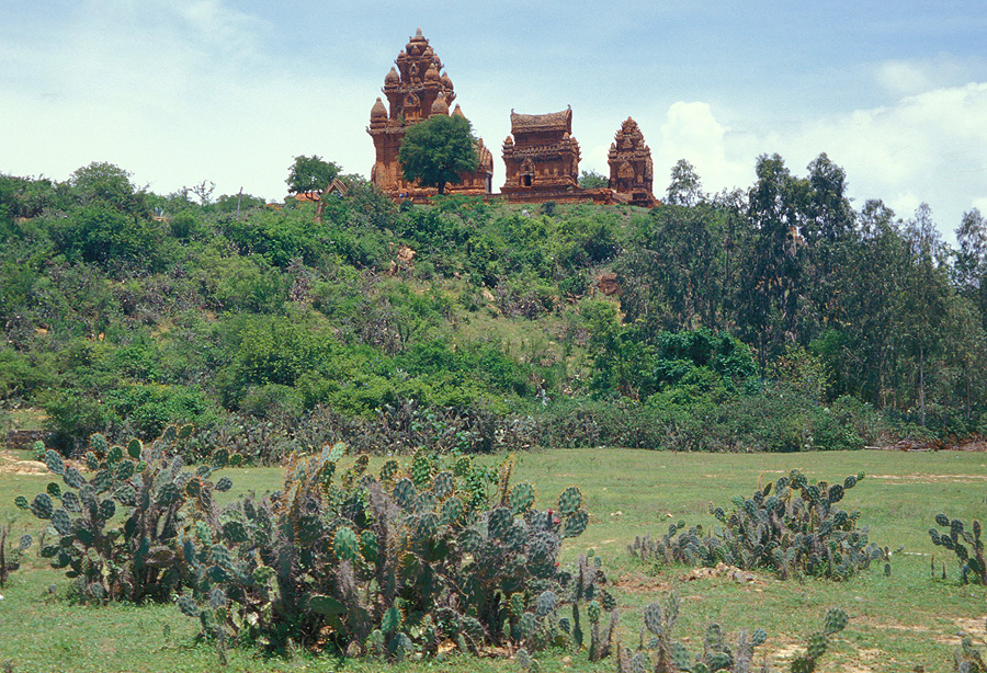
The Po Klong Garai Cham Towers, constructed
at the end of the 13th century, surmount a hilltop in the most arid region
of Vietnam -
Po Klong Garai Cham Towers, South Vietnam |
|
|
|
 |
|
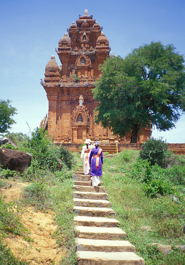
These lovely ladies, in
traditional dress, ascend the stairs to the the remains of the Hindu temple -
Po Klong Garai Cham Towers, South Vietnam |
|
|
|
 |
|
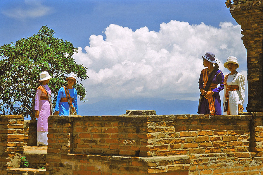
A better shot of the colorful,
traditional attire of the region -
Po Klong Garai Cham Towers, South Vietnam |
|
|
|
 |
|
The coast of the China Sea
normally has turquoise water except during the wet season when tropical downpours
muddy the water -
Nha Trang Beach, South Vietnam |
|
|
|
 |
|
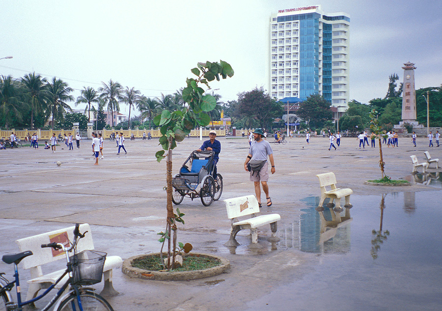
Brian is being politely harassed by
a rickshaw driver while strolling along the esplanade (war memorial in background) -
Nha Trang Beach, South Vietnam |
|
|
|
 |
|
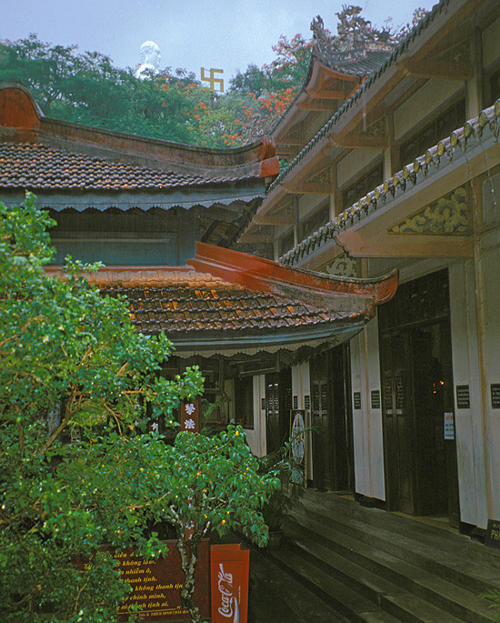
A view of the Long Son Pagoda and
its white, hilltop Buddha. The swastika symbol, just to the right of the
Buddha,
is actually an ancient symbol used historically by many civilizations and
religions - especially those cultures associated with the
Indian subcontinent. Prior to its adoption by the Nazi Party, the swastika
was used throughout the world without stigma -
Nha Trang, South Vietnam |
|
|
|
 |
|
This opportunistic beggar awaits
the foreign tourists who will be exiting a popular restaurant -
Nha Trang, South Vietnam |
|
|
|
 |
|
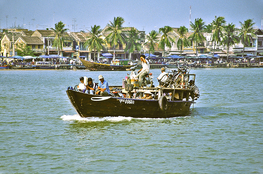
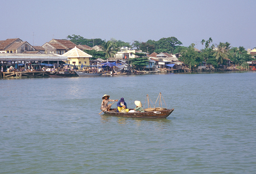
An old ferry transports
passengers along the Thu Bon River -
Hoi An, South Vietnam |
|
|
|
 |
|
A "private" ferry is slowly
paddled
across the river -
Hoi An, South Vietnam |
|
|
|
 |
|
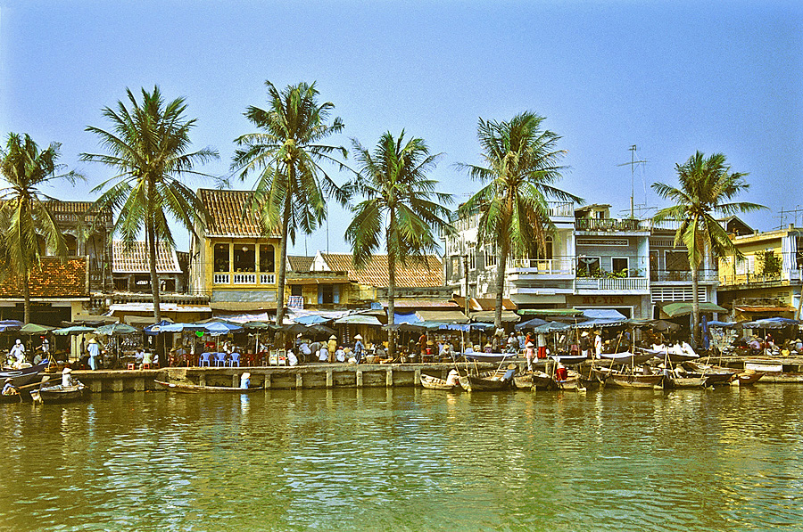
The bustling riverfront of what most
visitors agree is Vietnams most picturesque coastal town -
Hoi An, South Vietnam |
|
|
|
 |
|
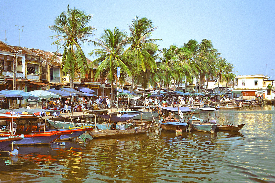
A close-up view of the boats that
ply the Thu Bon River -
Hoi An, South Vietnam |
|
|
|
 |
|
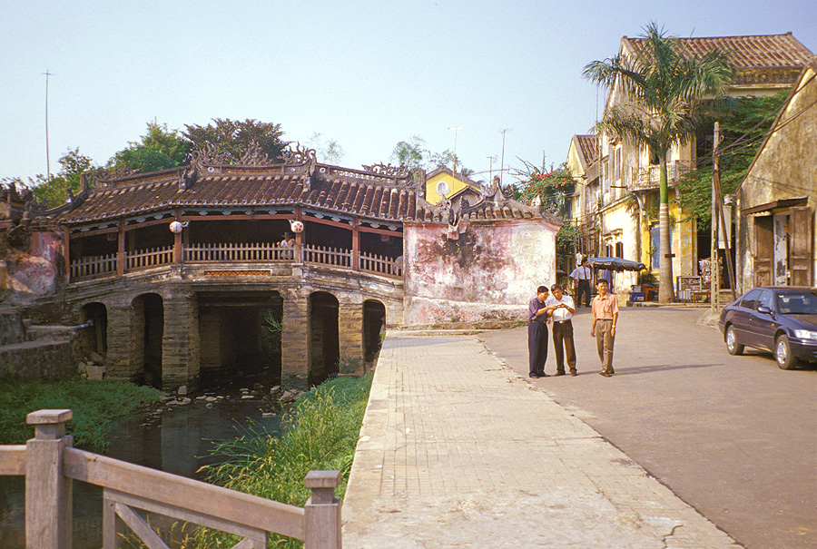
The famous Japanese Covered
Bridge, Hoi An's symbol, was constructed in 1593 to connect the Japanese
community with the Chinese quarter -
Hoi An, South Vietnam |
|
|
|
 |
|
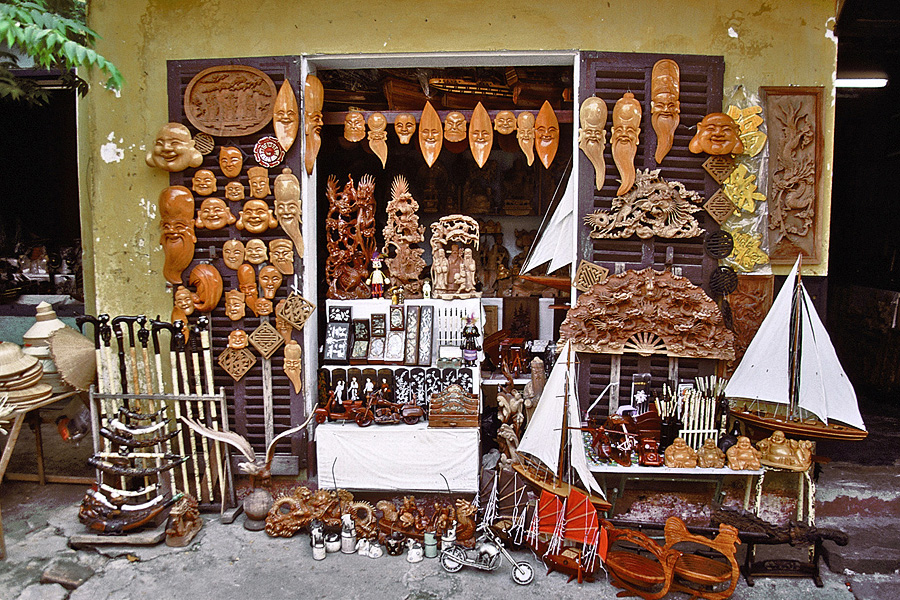
A variety of crafts are available
for the tourists who visit Hoi An, a UNESCO World Heritage Site -
Hoi An, South Vietnam |
|
|
|
 |
|
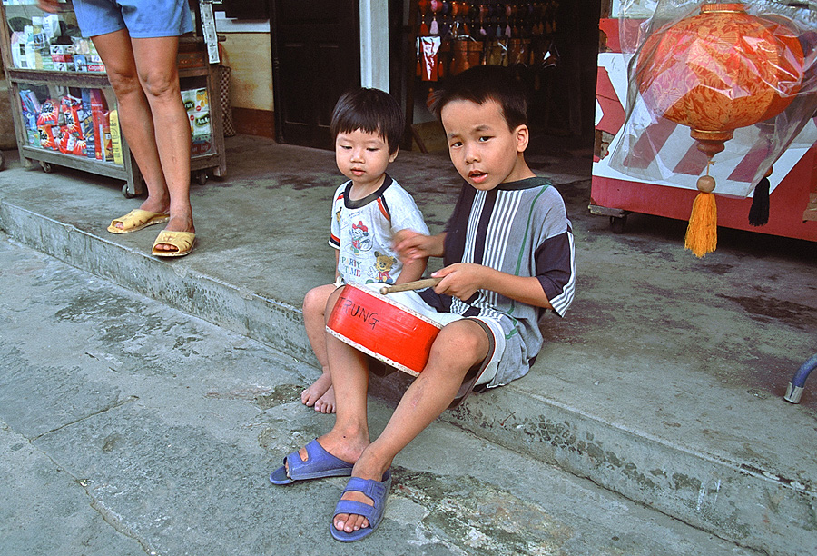
Perhaps a Vietnamese rock star in the
making? -
Hoi An, South Vietnam |
|
|
|
 |
|
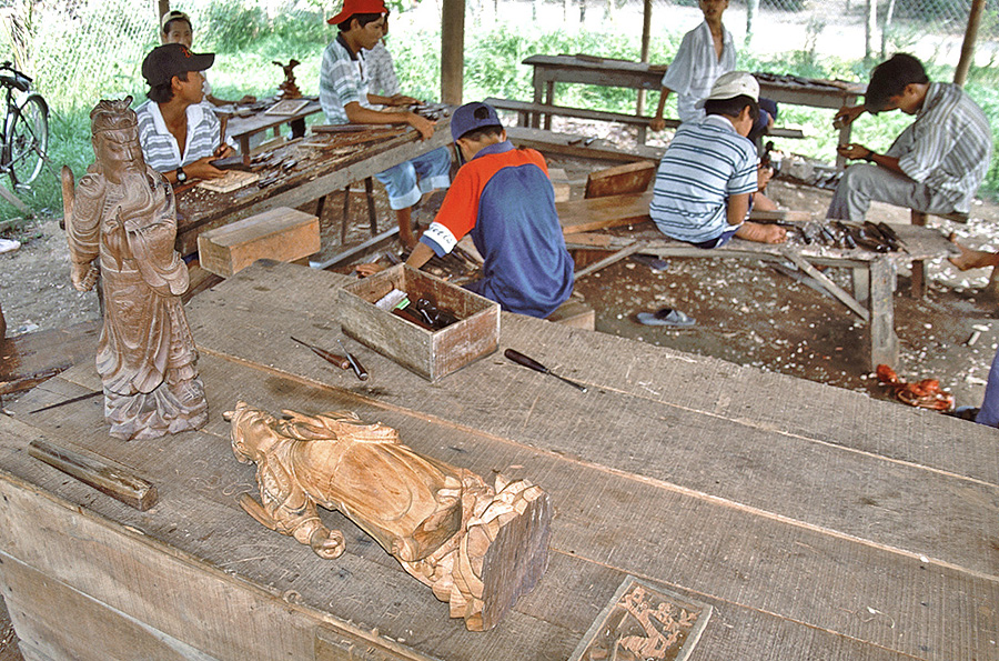
A plethora of craftsman, including
these master woodcarvers, work diligently on a small island on the Thu Bon River
-
Cam Kim Island, South Vietnam |
|
|
|
 |
|
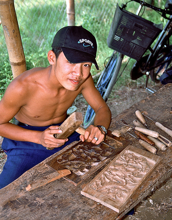
A craftsman at work -
Cam Kim Island, South Vietnam |
|
|
|
 |
|
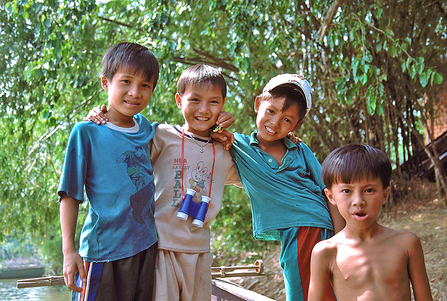
Only by utilizing the evasive skills of
James Bond could I escape the island's
aggressive peddlers and relax with the children -
Cam Kim Island, South Vietnam |
|
|
|
 |
|
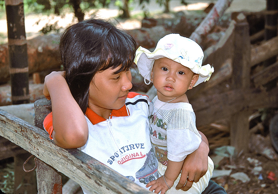
Perhaps you donated some of the
clothing worn by this young girl and child -
Cam Kim Island, South Vietnam |
|
|
|
 |
|
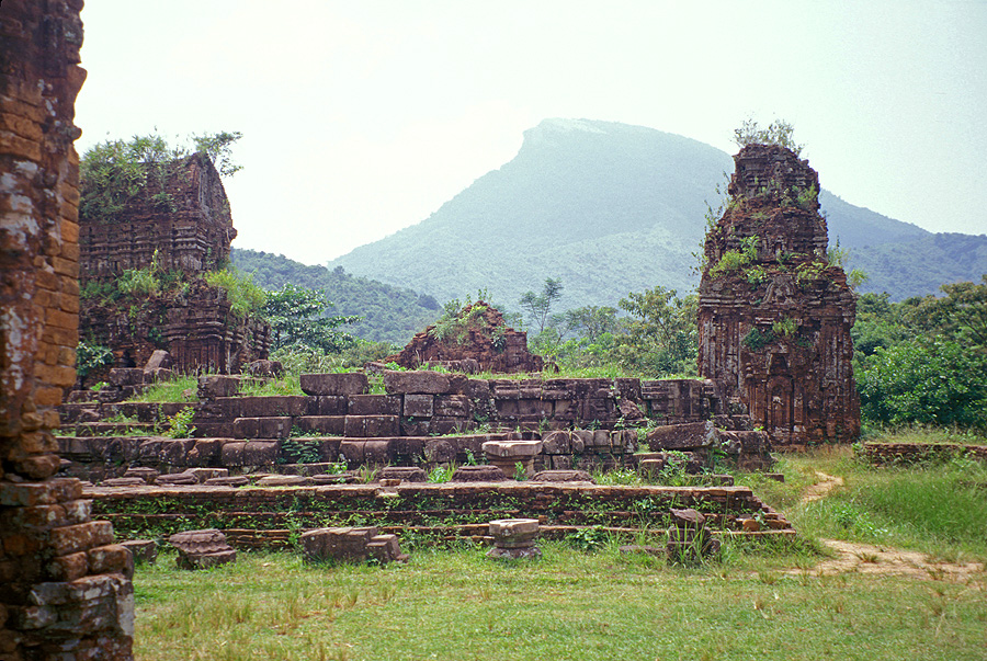
Vietnam's most important Cham
site, My Son, served as the intellectual and religious center of the
Indian-influenced Kingdom of Champa -
My Son, South Vietnam |
|
|
|
 |
|
This frightening ruin reveals some
of the damage incurred during the war -
My Son, South Vietnam |
|
|
|
 |
|
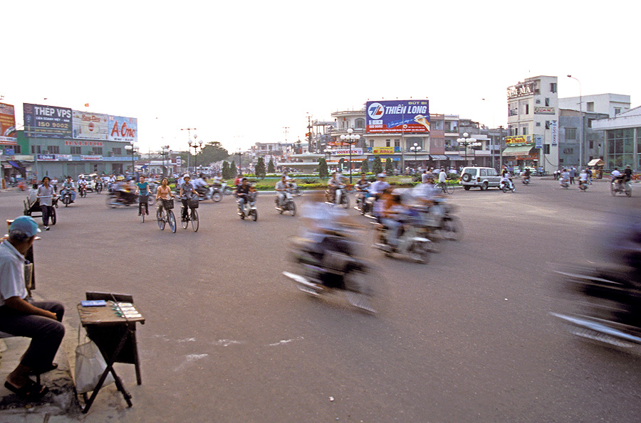
This busy roundabout efficiently
handles a variety of transport -
Danang, South Vietnam |
|
|
|
 |
|
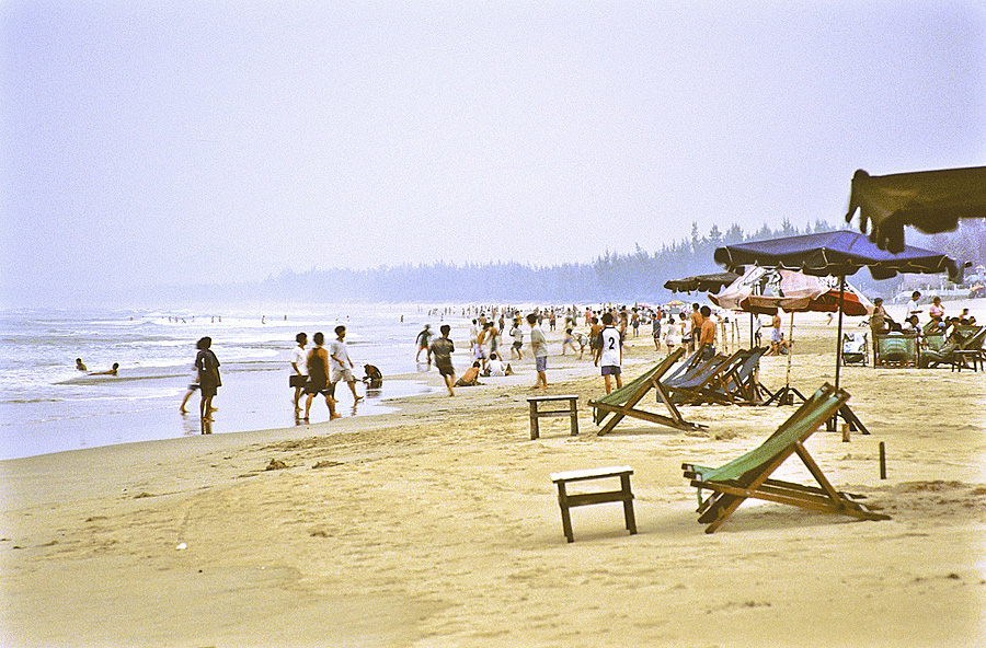
Throngs of Vietnamese now play on
the very beach where, only a few decades earlier, American soldiers were
airlifted in for rest and relaxation -
China Beach, South Vietnam |
|
|
|
 |
|
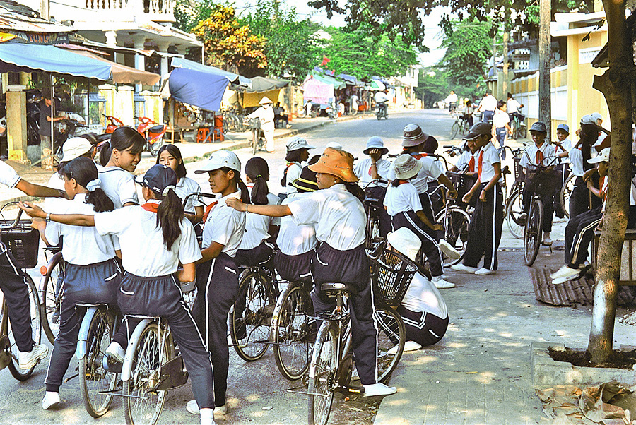
A large contingent of school girls and
school boys pause to make use of valuable shade -
Danang, Vietnam |
|
|
|
 |
|
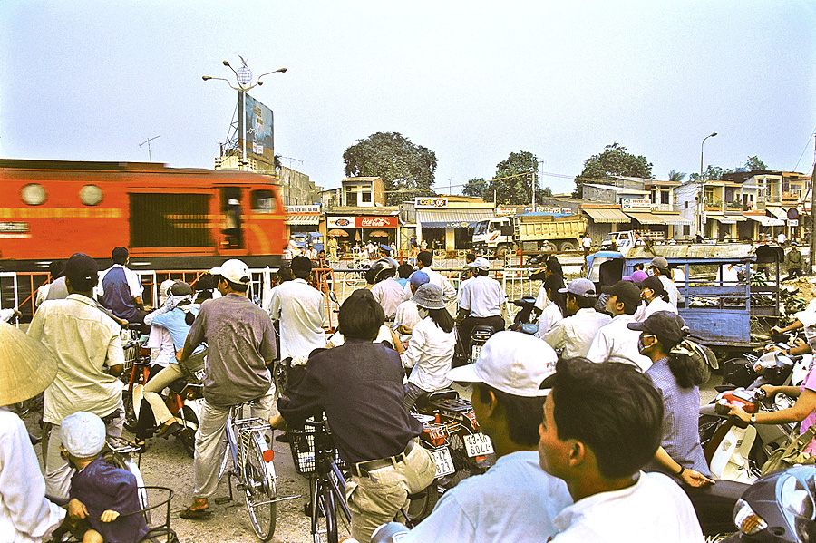
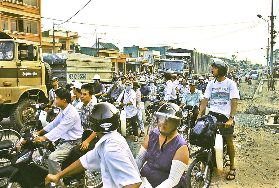
While waiting for a train, this
traffic backup reveals as much manpower as horsepower -
Danang, Vietnam |
|
|
|
 |
|
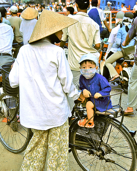
Mother and son waiting for the
train to pass; the mask is worn to protect the rider from dust -
Danang, Vietnam |
|
|
|
 |
|
The motorcycles and bicycles far
outnumber the trucks - but trucks always have the right-of-way! -
Danang, Vietnam |
|
|
|
 |
|
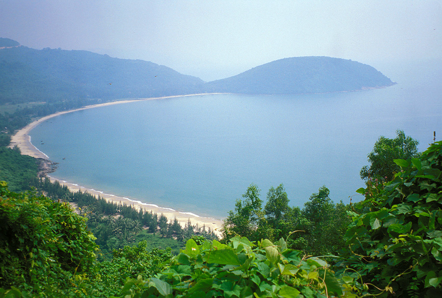
Hazy vista from just south of the Hai
Van Pass -
near Hai Van Pass, South Vietnam |
|
|
|
 |
|
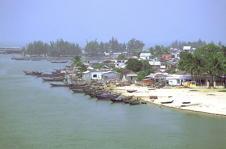
Close-up view of the bay side of Lang Co Beach -
Lang Co Beach, South Vietnam |
|
|
|
 |
|
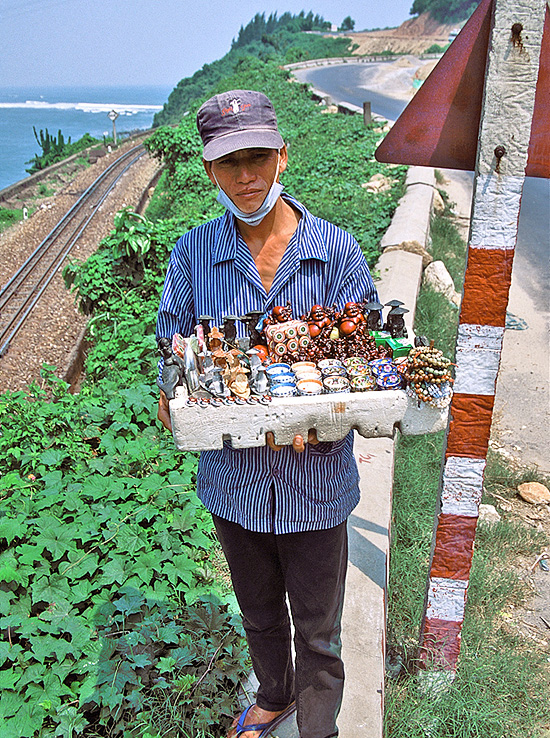
This vendor patrols the popular
overlook of Lang Co Beach. Many Vietnamese women
wear a face scarf for protection from the sun since they value pale,
unfreckled skin;
however, this gentleman is most likely wearing a mask for protection from
the dust -
near Lang Co Beach, South Vietnam |
|
|
|
 |
|
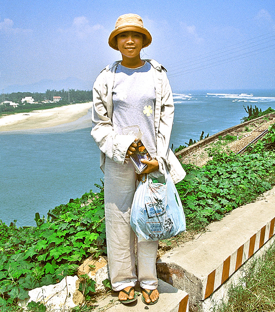
Photo of another vendor with the ocean
side of Lang Co Beach visible in the background -
near Lang Co Beach, South Vietnam |
|
|
|
 |
|
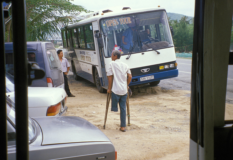
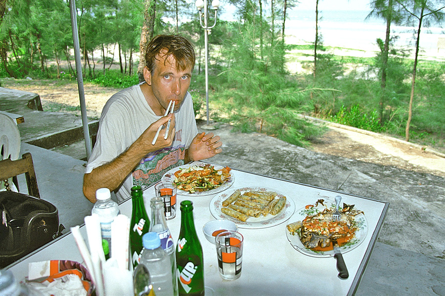
Delicious fresh seafood can be
purchased at a cheap price on the beach. However, ice-cold drinks must substitute
for air conditioning -
Lang Co Beach, South Vietnam |
|
|
|
|
|
| MORE
VIETNAM PICTURES |
|
|
|
|
|
|
|
Return to
Photo
Index
Return
to Clickable Map
Return to Home Page |
|
|
|
All images © Ron Miller
For authorized use of these photos, please contact Ron Miller at TheHappyCannibal@gmail.com |
|
|
|
|
|
|